January 31, 2017
There are two ways that you can use software to create a franchise territory network:
- Use an algorithm to automate the process
- Hand-build each territory
At Atlas Mapping, we firmly favour the hand-built approach, and this article provides some insight into why.
How does the automated process work?
Automation is very fast and can save an inexperienced “territory mapper” hours of trial and error work.
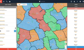
In simple terms, the software generates territories en-mass based on a target criteria you set which normally involves setting a target primary demographic (e.g. population) for the software to aim for in each territory.
More advanced software can also consider other parameters like road infrastructure and maximum geographical size. The software will then take these inputs and create territories by jiggling them around to optimise the balancing.
Unfortunately, there are some things that software will miss that hand building a territory network won’t (so long as the right person is making the territories of course!). We've identified some of these below.
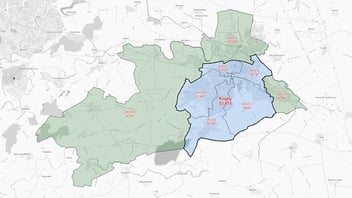
Identification of local markets
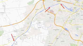
When software creates territories, the data provided doesn't contain intricate detail about the way in which an area is “made up”. For instance, a lot of communities will centre around a local high street or are divided by a "barrier" such as a train track or river. These local nuances play a pivotal role in the way a community will develop and interact with neighbouring areas.
Hand building your territories makes these key points much easier to identify and incorporate into a territory's design.
Correctly varying the size of territories
We advise that (for most franchise models) not all territories are created equal in terms of opportunity or geography. The towns and cities across a country are never evenly spread out, and therefore territories can never truly be “balanced” or “equal”. The reality is that the best territory networks also best represent the real local opportunity a franchisee/salesperson/store will likely cover. So this means that even if a town contains 50% more opportunity than you are aiming for, the whole town should be placed in a single territory.
Mapping software cannot make these decisions and will often split opportunities or localities while it strives to “balance” the territories.
(For more information on why whole markets should be taken into account check out our blog here)
Understanding your business model
Something that (for the time being) software just cannot do is make accurate judgements on territory decisions based on your unique business model. At Atlas Mapping, in each franchise territory mapping project there will be many areas where we will need to fully appreciate and understand the business model to make the correct territory design decision. This could be down to how customers typically reach a client’s service or vice-versa, the limits of how far an operator can reach, and even understanding where the business can’t go (because very few businesses can service everywhere).
Final thoughts
The reality is that a territory network created with automation needs so much editing at local levels that hand building it from the start actually works out to be more efficient. But of course, this is only the case when the territories are being built correctly and with the consideration required to make truly great networks and foundations for businesses to grow.